


Model Your Watershed with Free Web App
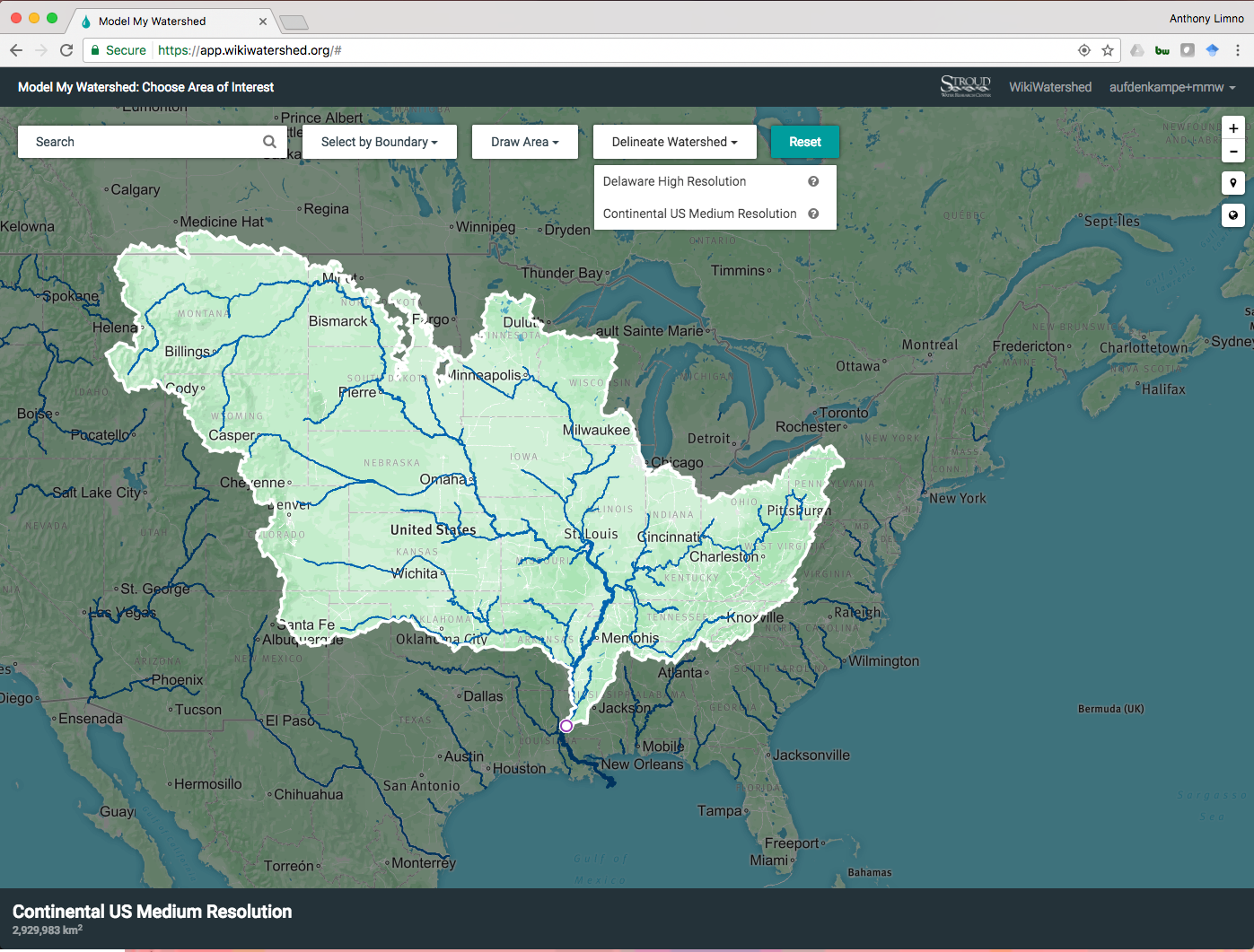
An innovative web tool called Model My Watershed allows anyone to map any watershed, at any location in the continental United States. And users don’t need any prior experience with geographical information systems (GIS) to use it.
Model My Watershed is part of the WikiWatershed toolkit developed by the Stroud Water Research Center and their partners.
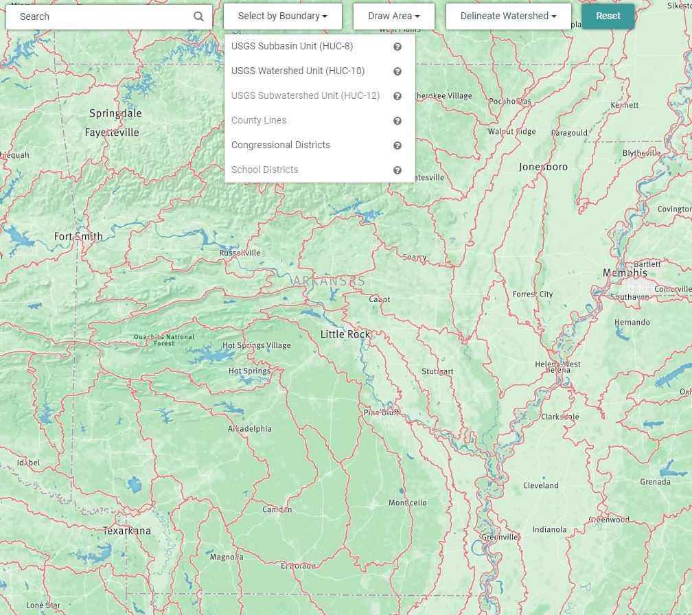
The latest version of Model My Watershed has new features to help individuals visualize and analyze watershed boundaries and water quality data. Users can search a particular watershed by hydrologic unit code (HUC), by dropping a point anywhere on the map, or by drawing a boundary free hand.
Anyone can gather information about land cover, hydrologic soil types, stream networks, and even estimations on the types and numbers of livestock in any given watershed.
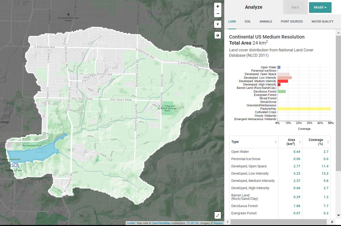
Once users identify their watershed, they can do things like create scenarios for a 24-hour storm event, and compare how changes in land use or adoption of conservation practices could affect hydrology and water quality.

For example, users can predict how a new subdivision affects rainfall runoff, water infiltration, and evapotranspiration. Then they can look at how using raingardens or permeable pavement could reduce the effect of that new subdivision.
Citizens, developers, water managers, and decision makers can use this tool to compare how different conservation practices can improve water quality and reduce the amount of rainfall runoff from storms.
Teachers and students are using Model My Watershed too. It’s a great way for students to learn about their watershed and how land use can affect water quality. It’s also a great way to engage students in STEM disciplines by developing their spatial and problem solving skills.
The tool is FREE, easy to use, accurate, and very fast. Each month brings new updates to expand the app’s features and improve the user interface. Current funding will allow for 18 more months of updates.
The Stroud Water Research Center developed Model My Watershed with partners including Azavea, the University of Washington Applied Physics Laboratory, the Concord Consortium, Meliora Design, Utah State University, the Academy of Natural Sciences of Drexel University, and Millersville University. The toolkit is funded in part by the National Science Foundation, William Penn Foundation Grants, Stroud Water Research Center, Virginia Wellington Cabot Foundation, The Dansko Foundation, Peter Kjellerup, and Mandy Cabot.
To learn more, go to https://wikiwatershed.org/.